
%20--%3e%3csvg%20version='1.1'%20id='Logo'%20xmlns='http://www.w3.org/2000/svg'%20xmlns:xlink='http://www.w3.org/1999/xlink'%20x='0px'%20y='0px'%20viewBox='0%200%20477.9%20233.5'%20style='enable-background:new%200%200%20477.9%20233.5;'%20xml:space='preserve'%3e%3cg%3e%3cpath%20d='M71.2,96.6l-21.1,54.8h12.5l3.8-10.3v0.1h21.5v-0.1l3.9,10.3h12.7L83,96.6H71.2z%20M69.6,131.4l7.5-21.9l7.3,21.9H69.6z'/%3e%3cpath%20d='M133.5,110.4c-5.4,0-10.1,2.7-12.8,6.3V94.8H109v56.6h11.7v-5.9c2.9,4.2,6.7,6.7,12.6,6.7c12.2,0,19.6-9.4,19.6-21.1%20C152.9,119.9,146.1,110.4,133.5,110.4z%20M130.9,142.8c-5.7,0-10.5-3.7-10.5-11c0-7.4,4.5-12,10.8-12c6.4,0,10,5.2,10,11.3%20C141.2,137.7,137.3,142.8,130.9,142.8z'/%3e%3crect%20x='159.9'%20y='111.3'%20width='11.7'%20height='40.2'/%3e%3crect%20x='181.1'%20y='94.8'%20width='11.7'%20height='56.6'/%3e%3crect%20x='202.4'%20y='111.3'%20width='11.7'%20height='40.2'/%3e%3cpolygon%20points='275.3,136.4%20265.7,111.3%20252.6,111.3%20269.1,148.1%20259.9,169.8%20271.7,169.8%20297.7,111.3%20284.8,111.3%20'/%3e%3cpolygon%20points='335.9,129.7%20311.7,96.6%20302.4,96.6%20302.4,151.4%20314.6,151.4%20314.6,118.1%20338.7,151.4%20348,151.4%20348,96.6%20335.9,96.6%20'/%3e%3cpath%20d='M377.7,110.4c-12.9,0-22.2,9.3-22.2,21.1c0,11.4,8.1,20.7,23,20.7c5.4,0,13-1.6,18.7-7.9l-6.7-6.4c-2.8,2.7-7,4.8-11.1,4.8%20c-7.4,0-12.1-3.7-12.3-8.7h32.3C399.4,118.1,388.8,110.4,377.7,110.4z%20M367.3,127c1.4-5.4,6.4-7.1,10.2-7.1c3.9,0,9.2,2,9.9,7.1%20H367.3z'/%3e%3cpath%20d='M425.4,135.4v0.1v3.4c0,1.9-0.8,3.8-3,3.8c-2.3,0-3-1.8-3-3.5v-18.8h11.1v-9.2h-11.1v-9.9h-9l-1.8,9.9h-6.9v9.2h6v17.7%20c0,11.7,6.9,14.2,13.9,14.2c5,0,8.4-1.7,10.6-4.1c2-2.2,2.8-5.1,2.8-7.9v-4.9H425.4z'/%3e%3cpath%20d='M243.9,135.4v0.1v3.4c0,1.9-0.8,3.8-3,3.8c-2.3,0-3-1.8-3-3.5v-18.8H249v-9.2h-11.1v-9.9h-9l-1.8,9.9h-6.9v9.2h6v17.7%20c0,11.7,6.9,14.2,13.9,14.2c5,0,8.4-1.7,10.6-4.1c2-2.2,2.8-5.1,2.8-7.9v-4.9H243.9z'/%3e%3cpath%20d='M214.8,100.9c0-3.3-2.9-6-6.6-6c-3.6,0-6.6,2.7-6.6,6c0,3.3,2.9,6,6.6,6C211.8,106.9,214.8,104.2,214.8,100.9z'/%3e%3cpath%20d='M172.3,100.9c0-3.3-2.9-6-6.6-6c-3.6,0-6.6,2.7-6.6,6c0,3.3,2.9,6,6.6,6C169.4,106.9,172.3,104.2,172.3,100.9z'/%3e%3c/g%3e%3cpath%20d='M275.2,78.4c2.2,1.3,0.6,4.7-1.8,3.7c-3-1.2-6.1-2.4-9.2-3.5c-10.4-3.7-21-6.8-31.8-9.3c-21.4-4.9-43.4-7.6-65.2-7.6%20c-21.9,0.1-43.8,2.5-65.3,7.4C88.1,72.3,74.3,76.5,61,82c-2.4,1-4-2.4-1.8-3.7c2.9-1.7,5.8-3.3,8.8-4.9c10.1-5.2,20.8-9.4,31.7-12.7%20c21.8-6.7,44.7-10.1,67.6-10.1c22.9,0,45.8,3.6,67.5,10.3c10.9,3.4,21.5,7.6,31.6,12.8C269.4,75.1,272.3,76.7,275.2,78.4z'/%3e%3cpath%20d='M343.2,167.9c-1.5-1.2,0.2-3.5,1.9-2.5c4.8,2.6,9.8,4.7,14.9,6.3c9.4,3,19.3,4.4,29.1,4.4c9.9,0,19.8-1.4,29.2-4.3%20c5.2-1.6,10.2-3.7,15-6.4c1.7-1,3.4,1.3,1.9,2.5c-4.4,3.6-9.4,6.6-14.8,8.8c-9.8,4.2-20.6,6.1-31.3,6.1c-10.8,0-21.5-2.1-31.3-6.3%20C352.6,174.4,347.6,171.5,343.2,167.9z'/%3e%3c/svg%3e)

Navigate & Explore, all working together.
Choose the best route for your journey with shades and accessible infrastructure. Hear about obstacles, traffic lights, and crossings as you walk. Now, it all works within a single app. It's that easy.
People with visual impairments around the world are using Orinav to transform their navigation experience. Find your way and understand your surroundings: for the first time, it all works in a single app.
'%3e%3cpolygon%20class='cls-1'%20points='38.12%20119.35%20119.4%20140.4%20165.57%2065.63%20169.63%20153.42%20250.91%20174.47%20172.14%20207.67%20176.21%20295.45%20123.46%20228.19%2044.7%20261.39%2090.87%20186.61%2038.12%20119.35'%3e%3c/polygon%3e%3cpath%20class='cls-2'%20d='M178.49,301.61l-55.66-70.99-83.13,35.04,48.73-78.91-55.53-70.82,85.57,22.17,48.8-79.02,4.29,92.78,85.57,22.17-82.93,34.95,4.29,92.64ZM124.1,225.75l49.82,63.54-3.84-82.93,74.61-31.44-76.98-19.94-3.83-82.79-43.55,70.52-76.98-19.94,49.96,63.71-43.62,70.63,74.41-31.36Z'%3e%3c/path%3e%3c/g%3e%3c/svg%3e)

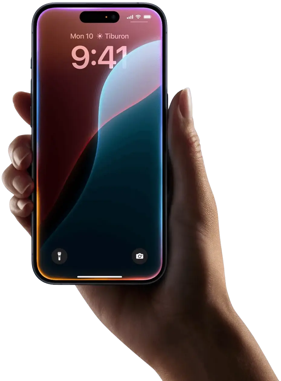
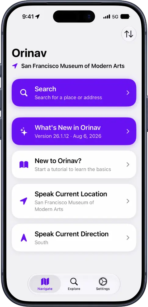
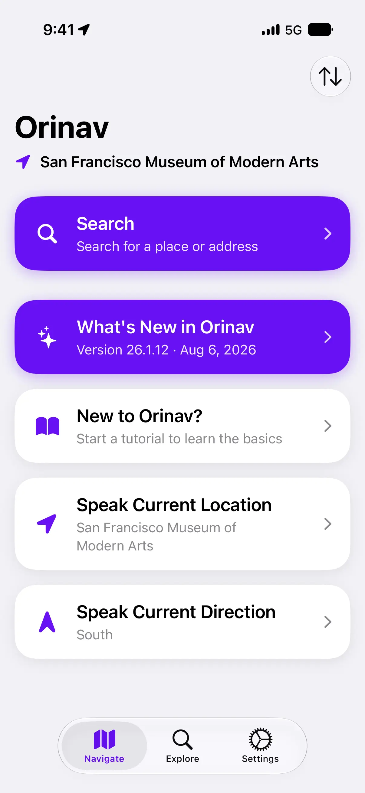
Showing Ready to go. 3 routes available: 22 min · Tactile pavings. Hazards reported: Construction on Friary Road. Favorite location: San Francisco Museum of Modern Arts.
Orinav is the first navigation app to bring accessible route planning and real-time environmental recognition together, helping you travel with more confidence at every stage.
Choose the best route for your journey with shades and accessible infrastructure. Hear about obstacles, traffic lights, and crossings as you walk. Now, it all works within a single app. It's that easy.
Try Navigate: Frequent route updates always keep you in the loop.
Orientation
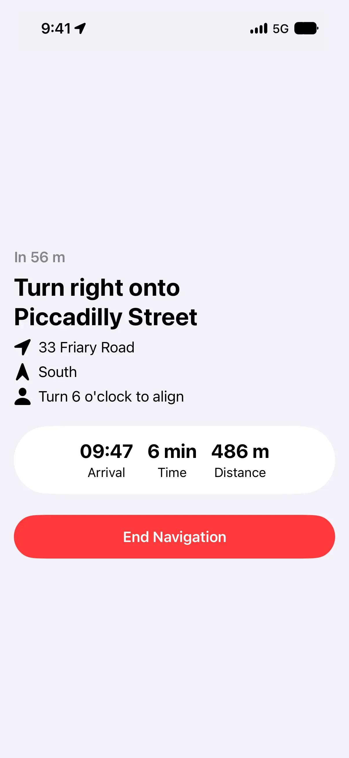
Turn 4 o'clock to align with Friary Road.
Next Step
Take 12 steps, then turn right onto Piccadilly Street.
Environment
Obstacle-dense zone ahead.
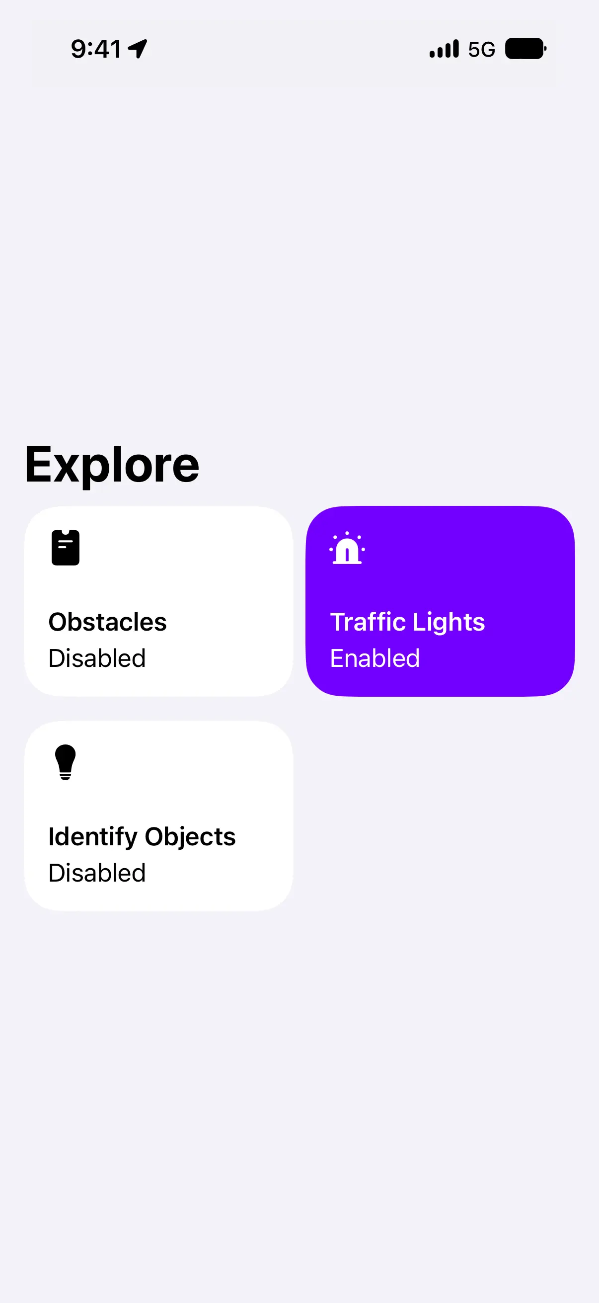
Try Explore: Hear your surroundings with AI-powered environment recognition.
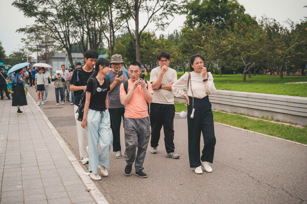
Whether you travel every day or once a month, Orinav's Navigate gives you the right information at the right moment. Hear when to take your next turn and how many steps remain. Get clear guidance on which direction to face. Simply march ahead and hear it when you need it.
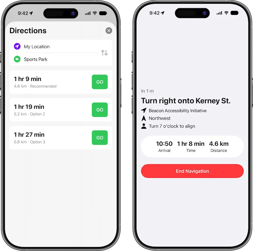
An easy way to know where to face.
Orinav uses prompts like "Turn 3 o'clock" to help you face the right way. No more fussing with angles or imperceptible directions!
Exactly the information you need, exactly when you need it.
Orinav uses your navigation context and on-device intelligence to deliver the information you need: traffic lights, crossings, hazards, obstacle-dense zones, car parks, among others.
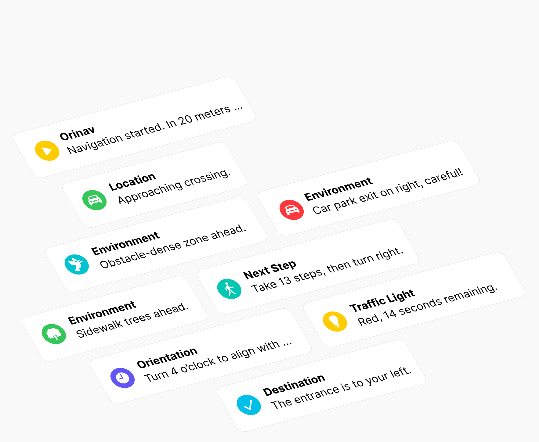
Discover what is around you with a simple raise of your phone. Orinav Explore works in parallel with Navigate to identify nearby obstacles, objects, and traffic lights as you move. Get immediate information whenever you need a clearer sense of your surroundings.
We know getting directions is only part of the journey. That's why Orinav identifies obstacles and nearby objects, while recognizing traffic lights and more as you move.
Smart integration. Orinav uses your navigation context to automatically enable features you need, when you need them.
All in one app. With all the features you need for safe, independent navigation, Orinav eliminates the need for switching between multiple apps.
Privacy by default. Our Explore features use on-device machine learning so your data always remains yours.
No additional hardware. You don't have to buy any vests, glasses, backpacks, or cameras.
Watch Orinav help DC travel independently as he pursues his dream of going to college.
Orinav is made by a team of high school students at Beijing Academy, mentored by the Tsinghua University Institute for Accessibility Development.

Founder & Lead Developer

Founder & iOS Developer

Android Developer

Community Manager

Community Manager (Retired)
It's free to get started. Download the app today and take your next step towards independent travel.


*Statistics sourced from study commissioned by A11yLab with 18 participants with varying degrees of visual impairments on a typical suburban route. Compared to Amap, a mainstream Chinese navigation application with ~1 billion monthly active users, Orinav achieves these results with a statistically significant effect.